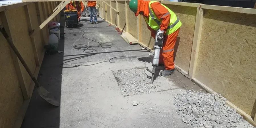
Cambridge sits barely 6 metres above sea level on the River Cam's floodplain. That low elevation fools many into thinking slope failures are not a local concern. They are. The Gault Clay Formation underlies much of the city and its behaviour changes dramatically with seasonal saturation. A 2022 Cambridgeshire County Council infrastructure assessment flagged twenty-three embankment sections along guided busways and former railway cuttings with marginal stability scores. We provide slope stability analysis that interprets the geological transitions from river gravels into the deeper Ampthill and Kimmeridge Clays. The work informs planning applications, retaining wall designs, and cut-and-fill sequences for basement excavations near the historic colleges. Every assessment references BS 5930:2015 field descriptions and BS EN 1997-1:2004 design approach DA1.
The Gault Clay–chalk interface governs slope stability across Cambridge—ignore that horizon and the factor of safety becomes meaningless.